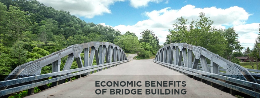
Most of us don’t notice much about the bridges and roads that connect our cities and states. However, we would certainly notice if we woke up one day and they weren’t there. Bridges play a crucial role in various aspects of modern life, enabling us to get to work or school and contributing to the country’s economic development. This, of course, is something the American Society of Civil Engineers knows well. Every four years, this all-important group releases a bridge report card, assessing how these structures are holding up. Read on to learn more about bridge economic impact and what we can do to protect these structures moving forward.
Aiding in Infrastructure
Bridge economic impact starts with the way they support the transport of people and goods. Along with allowing companies to ship materials, bridges enable consumers to travel to shops and malls and visit new cities as tourists. When a bridge goes down, the surrounding area experiences a halt in economic activity, as people can no longer purchase goods and services with the same ease.
Supporting the Local Economy
Bridges also support the local economy, thanks to wages paid to construction workers and repair crews. Even the most well-designed bridges require regular cleaning and maintenance. Bridge workers then give this money back to the local community by paying taxes and purchasing local goods and services.
Connecting Communities
Bridge economic impact issues go beyond simple cash flow. Bridges connect people in different communities, allowing them to interact for work or play. This capacity is especially essential for areas where one town has an abundance of raw materials and another has a labor force in need of work. In this way, both people and communities can support one another.
What’s to Come for Our Nation’s Bridges
In assessing the country’s bridges, the American Society of Civil Engineers determined that the average bridge age is rising. As result, the United States will need to spend $120 billion or more to complete the necessary repairs and get all the bridges up to code. That’s where companies like U.S. Bridge can help.
Contact Us for a Consultation
As a leader in bridge design and manufacture, U.S. Bridge helps communities create safe, longer-lasting bridges. Plus, we build many of our bridges using prefabricated panels and assemble them in modules to expedite construction. For more about our services, call today or contact us online.
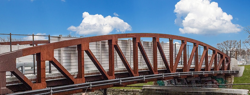
Have you ever driven over a bridge and wondered how old it was? In the United States alone there are more than 617,000 bridges, 12% of which are aged 80 years or older. But were all those bridges created at the same time or with the same method? What exactly is the typical lifespan of a bridge? And how many bridges are considered structurally deficient?
Contributing Elements to a Bridge’s Lifespan
Nowadays, bridges have become a natural part of everyday life. Your daily commute may even consist of traveling through a bridge or maybe two. Since they are vital to our economy and public safety, the government periodically mandates national bridge inspections to determine structurally deficient bridges.
Ultimately, there is no one number that fits the lifespan of all bridges across America. Each bridge has its own expected lifecycle but there are ways to estimate its lifespan. Generally, it’s believed that bridges are expected to function for 50-70 years however this is often not the case. Currently, only 42% of all bridges in the United States are at least 50 years old.
The lifespan of a bridge differs according to its design, construction, and location. Each component contributes either positively or negatively to the overall lifespan and structure of a bridge.
Materials
One of the most obvious factors that contribute to the lifespan and eventual structural deficits of a bridge is the material. In fact, both the concrete industry and the steel industry claim several advantages above the other for the Life Cycle Costs of a bridge.
Steel
Steel is a popular construction material due to its flexible and durable nature. The great thing about steel is that it is recyclable and still maintains its initial strength and integrity. Galvanized steel is even more durable plus it requires less upkeep.
Structural steel is a high-quality material that is readily available worldwide in certified grades and produced in various shapes and sizes. Currently, it is estimated that steel bridges have a lifespan of over 100 years. However, this number rapidly decreases as the bridge erodes or even with poor construction quality.
The deterioration of a bridge is created by a combination of several elements, for steel, it is often caused by corrosion, fatigue, stress corrosion, and damage from accidents.
Concrete
Another commonly utilized material is concrete. Concrete bridges are estimated to have a lifespan of over 100 years, again this number changes with daily wear and tear.
The causes of concrete deterioration are typically cracking, spalling, scaling, corrosion, and damage from accidents. In addition, cracks over reinforced steel allow water and chemicals to penetrate accelerating rusting which exerts great forces that pop the concrete.
Not to mention, extreme weather conditions, the presence of chlorides in de-icing salts, and cycles of freeze and thaw all contribute to the erosion of a bridge and its lifespan.
Timber
Timber, which is used for short-span and rural areas or pedestrian bridges is estimated to last only 20–30 years. This could be due to several reasons such as many engineers are less familiar with this material than their counterparts, or because there are fewer treatment options available for timber.
Nevertheless, the accurate range of which timber lasts is uncertain as there are very few data that exist that are based on actual performance data.
However, that doesn’t make timber a poor option. Timber is a lightweight material compared to concrete but still strong. This advantage plus low maintenance and repair costs make timber ideal in certain situations.
Plus studies suggest that timber is a durable option in highway bridge superstructures and that it can perform well for more than 70 years when properly pressure-treated with preservatives.
Location
The location of a bridge plays an instrumental part in its overall structural deficiency. Depending on the environment, it could accelerate the deterioration of the bridge.
Recently, there has been a slightly positive trend in addressing the maintenance of structurally deficient bridges. However, progress is not universal because states face different challenges when it comes to maintaining, repairing, and replacing bridges.
Urban
When it comes to urban locations, the major factor to watch out for is a higher traffic volume. The combination of a heavier load and volume further leads to the wear of the bridge. There are various ways for builders to slow this process down such as galvanization and other special treatments.
Rural
Unlike urban settings, rural bridges don’t have such a large volume of traffic. Unfortunately, it is because of this that rural bridges are typically not designed to withstand the growing numbers and weight of traffic and freight trucks. In actuality, rural bridges and transportation play a key role in our economy’s success and for rural communities.
However, more and more bridges in rural communities are experiencing rapid deterioration without the proper care and maintenance to last.
Coastal
Bridges that are located in coastal environments face unique challenges due to their location. Bridges in marine environments often experience corrosion-induced damage due to high sea salt and humidity. In addition, strength loss in the splash and the tidal zone is more common and significant than in the atmospheric zone.
An example of the distinct problems faced by coastal bridges is illustrated by the Morandi Bridge in Italy. In 2018, this cable-stayed bridge suddenly collapsed causing the death of 43 individuals. The collapse was reported as the fault of a weakened cable that deteriorated from corrosion. The degradation was caused by atmospheric agents and the proximity of the marine environment eroded the structure and integrity of the bridge.
Structural Deficient Bridges in America
Structurally deficient bridges are those that are in need of repair or maintenance due to the deterioration incurred throughout the bridge’s lifetime. Recently, 7.5% of highway bridges were designated structurally deficient. This is a striking improvement from the previous 12% record. In addition, the average age of America’s bridges is increasing to 44 years.
The plan is that the overall lifespan of a bridge should increase over time as more techniques, treatments, and designs are discovered in the future.
Build a Bridge that will Last Lifetimes with U.S. Bridge
Are you looking for an experienced industry leader company to assist with your building projects? Here at U.S. Bridge, we’ve built for different projects all across the globe; and we know that choosing the right material for your bridge takes a combination of experience, expertise, and skill.
On this day in history – March 23, 1977 – the Francis Scott Key Bridge that spans the Patapsco River in Baltimore opened to traffic. Besides the famous name, the bridge was a major milestone in Maryland’s transportation planning and remains the second longest continuous truss bridge in the United States.
[Edited to note that this post originally appeared on our website on March 23, 2017. On March 26, 2024, the Key Bridge was tragically struck by a ship, The “Dali,” and was a total loss. As of the time of this edit, the full story of its destruction is not yet known, but lives are feared lost in this unfolding tragedy.]
While most Marylanders have heard of Francis Scott Key and his poem that inspired the Star Spangled Banner, many may not know the story of the bridge that bears his name.
The Key Bridge was a major milestone for the development of the Maryland highway system as it completed the Interstate 695 circuit around Baltimore. It is also a significant engineering accomplishment – and it is one of the longest continuous truss bridges in the United States.
To address Baltimore’s growing problem with traffic congestion, the State Roads Commission, predecessor of the Maryland Transportation Authority, suggested a second tunnel be constructed to reduce traffic volume through the Baltimore Harbor Tunnel. After project proposals proved too expensive, state officials proposed a four-lane bridge that would carry more traffic, allow for transportation of hazardous materials and have lower operating costs than a tunnel.
Construction began in August 1972 with the Baltimore firm J. E. Greiner Company serving as the primary engineering consultant. Originally expecting to build a two-lane tunnel, contractors built two-lane approaches on both sides of the harbor, which were not widened to four lanes until 1981. The northern approach had an elevated viaduct and bridge over Bear Creek and passed by Bethlehem Steel complex at Sparrow’s Point. This section of the bridge highway was widened and reconnected to other roads in 2000.
The southernmost transportation route across the Patapsco River, the Key Bridge, runs 1.6 miles and connects Sollers Point to Hawkins Point. The continuous steel truss bridge is 185 high and spans a distance of 1,200 feet. Including connecting approaches, the bridge is 10.9 miles long. Funded entirely by Maryland Transportation Authority toll bonds, the bridge cost $60.3 million. These days, the bridge carries an average of 10.4 million vehicles across the Patapsco River each year.
BRIEF HISTORY OF FORT CARROLL
Historians believe the bridge is within 100 yards of where Francis Scott Key was kept aboard the British flagship HMS Tonnant and wrote his famous poem that went on to become the National Anthem of the United States. On the southern side of the bridge is another monument to 19th century Baltimore history – Fort Carroll. Named after Charles Carroll (1737-1832), a Maryland political leader and the last surviving signer of the Declaration of Independence, the fort sits abandoned near the opening to the Chesapeake.
Constructed between 1847 and 1850, the fort was built by the U.S. War Department to suppliment the protections offered by Fort McHenry, but proved ineffective especially due to frequent flooding that spoiled ammunitions and thus, the fort was used minimally between the Civil War and the Spanish-American War. Later, a lighthouse to help ships avoid the fort and demarcate two lanes for marine traffic, yet the Army abandoned the fort in 1921. Ownership of the land and the fort changed hands several times and still remains abandoned and decaying.Greenville’s unique Liberty Bridge honors Liberty Corporation founder W. Frank Hipp and his children, Francis M. Hipp, Herman N. Hipp, B. Calhoun Hipp, and Dorothy Hipp Gunter for their commitment and contribution to the Greenville community.
The $4.5 million structure was funded by the City of Greenville’s Hospitality Tax, which must be spent on tourism-related facilities
CONSTRUCTION
The Liberty Bridge was constructed over a period of 12 months by Taylor and Murphy Construction Co. of Asheville, N.C., designed by bridge architect Miquel Rosales of Boston, and engineered by Schlaich Bergermann.
Chris Britton, structural division manager for Taylor and Murphy, describes the bridge as “an ultra lightweight bridge, which almost looks like it’s floating on air.”
At 345 feet long, 12 feet wide and 8 inches thick, the concrete reinforced deck is supported by a single suspension cable. The deck’s distinctive curve has a radius of 214 feet and it is cantilevered toward the waterfall from supporting cables on the outside. The bridge deck also inclines 12 feet or 3% from east to west over the river.
SUPPORTS & STABILITY
There are 3 primary cable systems that work with and against each other to support the bridge and hold its position. Underneath the deck, three 80 millimeter diameter “ring” cables provide support and place it into compression in the horizontal plane. The 28 millimeter hanger cables work against the ring cables horizontally and with them vertically.
The hanger cables are set at 35 to 60 degrees from vertical and are supported by the catenary or main cable. The main cable is actually 3 separate 80 millimeter cables – 2 spanning from the abutment blocks to the steel mast and 1 spanning from mast to mast in the center of the span.
The 2-90 foot tall masts weight more than 28 tons each and lean away from the bridge at a 15 degree angle. There are 80 millimeter backstay cables that hold the masts in position. Steel piles and rock anchors, 70 feet deep into bedrock, transfer the bridge loads to the ground at the abutments, mast and backstay foundations.
SETTLING GREENVILLE
While bridges with similar structural concepts have been built in Europe, this bridge is unique in its geometry and there is nothing like it in the United States.
Below the bridge the 28 foot Reedy River Falls is the site where Greenville’s first European settler, Richard Pearis, established his trading post in 1768. Later he built grist and saw mills at this same location which was the hub of early industry in Greenville until the 1920s.The river is an important part of what makes Tara Wildlife so special. It helps to add to the beauty of this place and it supports an abundance of wildlife, attracting birds on their migration, providing food and habitat for many critters, and opportunities for recreation for us!
These are just some of the amazing things about the Mississippi River:
#1 There are over 260 species of fish in the Mississippi River and its floodplains.
That is 25% of the fish species in all of North America!
#2 It is the second longest river in North America.
It is second to the Missouri River, which is about 100 miles longer.
#3 The speed of the river is faster when it reaches to Gulf.
The speed of the river at the headwaters in Minnesota is about 1.2 miles per hour but when it reaches New Orleans, the speed is 3 miles per hour.
#4 The Mississippi Flyway is a major migration path for birds that follows along the Mississippi River.
It is used by about 40% of the migratory birds that spend the spring and summer in the U.S.
#5 The Mississippi River collects the water that drains from 31 states and 2 Canadian provinces.
That’s 41% of the U.S. that drains in to the river.
#6 The river helps to define part of the borders of 10 U.S. states.
It defines the borders of Minnesota, Wisconsin, Illinois, Kentucky, Tennessee, Mississippi, Missouri, Louisiana, Iowa, and Arkansas.
#7 The Mississippi River drops about 1,475 feet along its length.
It starts out at 1,475 feet above sea level in Minnesota and drops to sea level at the Gulf of Mexico. That’s a change of 1,475 feet along its length.
#8 700 miles of the Mississippi River is free of dams
The portion of the river from St. Louis to New Orleans (700 miles) is free of dams which allows large trains of barges – some as long as 2,000 feet – to transport commodities between these two cities.
#9 The Mississippi River is a major transportation route for goods and commodities.
Approximately 460 million tons of freight are transported on the Mississippi River each year. Commodities transported on the river include agricultural crops, coal, steel, petroleum, and aluminum.
#10 The widest point of the Mississippi River is 11 miles!
It is located at Lake Winnibigoshish in Minnesota.
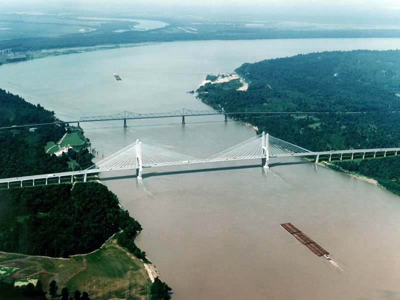
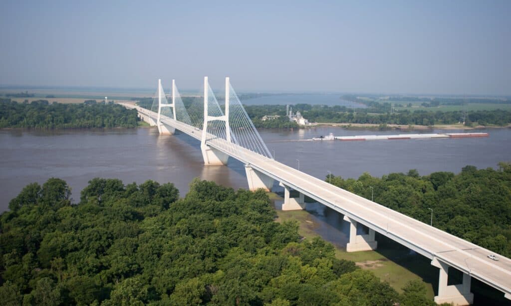
Hwy 82 Bridge – Greenville, MSSequel Electrical Supply LLC – Jackson, MS partnered with Synergy Electric and another contractor on these MDOT projects for the Greenville, MS bridge on US 82. The Greenville Bridge is a cable-stayed bridge over the Mississippi River, carrying US 82 and US 278 between Refuge, Mississippi, and Shives, Arkansas. When the bridge opened in 2010, it was the fourth-longest cable-stayed bridge in the US.
The project consisted of upgrading all aesthetic lighting on the bridge to new, more energy efficient LED fixtures manufactured by Phoenix Lighting. Synergy Electric replaced all roadway and approach lighting for the bridge with new Autobahn LEDs by American Electric Lighting.
It was a rare and welcomed opportunity to be a part of this LED lighting project.
Eads Bridge in St. Louis is a feat of engineering that remains the oldest bridge crossing on the Mississippi River, at over 145 years old, people still cross it today. As much as it was a marvel, it was also a deathtrap for many of the workers. The Missouri Historical Society dug into what happened (pardon the pun).
James B. Eads, ca. 1884. Missouri Historical Society Collections.
~EADS BRIDGE~
In the 1860’s when project engineer and designer, James B. Eads, began building the bridge many people thought it was an impossibility. To build a bridge across an active river that saw a million people a year in and out of St. Louis, without disrupting the river trade, seemed unlikely. In addition Eads needed workers to dig 50 feet below the bed of the river to hit bedrock.
Dr. Alphonse Jaminet, 1870. Missouri Historical Society Collections.
~DIGGING DEEP~
Eads utilized a form of a diving bell, called a caisson, to allow workers to dig into the Mississippi River bed. But to hold back the river, the air pressure in the caisson had to be increased to 40 times what it is on the surface. Workers talked about squeaking voices and the strange way the candles burned. Three years into the construction of the bridge, worker James Riley emerged from the caisson gasping for air. Within 15 minutes, he was dead. By week’s end, four more workers had died.
~DECOMPRESSION SICKNESS~
Works in the caissons were dealing with decompression sickness, or the bends. Nitrogen was becoming trapped in their bloodstream and boiling as they climbed the stairs to the surface. Workers were spitting up blood, having excruciating pain in their limbs and stomachs, or having their legs go numb. In total 119 workers were affected by the illness and 14 died. What was happening to them was a mystery and Eads brought in his own physician to set up a floating hospital at the pier site.
~SLOW DECOMPRESSION~
Although Eads’ doctor, Dr. Alphonse Jaminet never quite understood what was happening to the workers, he did discover that gradual decompression was vital and his principles are still used today by divers. Eads Bridge was built to stand as long as St.Louis believed it to be of use to the city and cars still drive over the bridge, the metro train clambers along on the lower level, and walkers and bicyclists traverse the bridge for a unique view of the St. Louis skyline.
In April 1856 the Chicago and Rock Island Rail Road built a bridge across the Mississippi River. It linked the Chicago and Rock Island Rail Road in Illinois with the Mississippi and Missouri Railroad in Iowa. This bridge, which spanned the river between Rock Island and Davenport was very important for a number of reasons.
It was the first railroad bridge across the Mississippi River. A bridge across the Mississippi was necessary for the future transcontinental railroad. And the bridge was important because of controversy that surrounded it. The legal questions it brought forth gained national attention and forced the courts to make lasting decisions about bridge building.
In the 1850s when the bridge was built, steamboats were the main means of transportation for passengers and cargo along the Mississippi. Trains, however, could go places a steamboat could not, and the steamboat owners knew this gave trains a big advantage. If trains could get across the Mississippi, they could replace the steamboat as the main means of transportation.
Effie Afton Hits the Bridge
On May 6, 1856 a steamboat named Effie Afton crashed into the bridge, destroying the steamboat as well as part of the bridge. The owners of the Effie Afton decided to take the railroad companies that had built the bridge to court. They wanted the railroad companies to pay for damages to the Effie Afton and its cargo. They also wanted the court to declare the bridge a danger to river travel and order its removal. The case went to court in Chicago in September of 1857.
Initially, the Benjamin G. Humphreys Bridge connected Refuge, Mississippi, and Shives, Arkansas. But, as a bridge with only two narrow lanes and no shoulders, it became outmoded as traffic increased. And because the Benjamin Humphreys Bridge crossed the Mississippi River where the river sharply turned, barges and other boats often crashed into the bridge, failing to turn in time. By 1972, the Benjamin Humphreys Bridge had sustained more boat collision damage than any other bridge in Mississippi.
In 2001, the state began building the longest bridge in Mississippi. The Greenville Bridge is half a mile downriver from the old Benjamin Humphreys Bridge. In 2010 the Greenville Bridge opened to traffic, and a year later, the state took down the old Benjamin Humphreys Bridge.
The Greenville Bridge has four lanes of traffic and 122 feet of clearance for barges traveling underneath. Two concrete towers are anchored into the riverbed, 120 feet deep. And these towers stand at 425 feet above the river level. The main span stretches for 1,380 feet, and the total length of the longest bridge in Mississippi is 13,560 feet. This is truly an impressive bridge.
Animals Under the Longest Bridge in Mississippi
Because the Greenville Bridge crosses the Mississippi River, there are many interesting animals to spot:
A female black bear can weigh 180 pounds, and a male can weigh 660 pounds. But despite their size, they are quiet creatures. While cubs may moan when they are disconcerted, a female responds to her cubs with grunts to comfort or to signal the cubs to follow her.
But black bears do not growl if they sense danger. Instead, to warn the intruder, a black bear might huff, hit the ground, or even snap its teeth. If that doesn’t scare away the threat, then a black bear will make a fake charge, veering away at the last second.
A huge warning sign that a bear will be confrontational is if it sticks out its lower lip, flattens its ears, and gives you a stare-down. You may see a black bear get onto its hind legs, but this is out of curiosity, not aggression. They use this position to sniff the air or get a better view.
All in all, you will see black bears up and down the Mississippi River, including by the city of Refuge. It’s a fantastic water source with diverse food options for the black bear, such as fish, insects, and roots. Black bears are omnivores, so they have a variety of foods that they like to eat.
Not only is the Greenville Bridge the longest bridge in Mississippi, but it is also the longest cable-stayed bridge in North America. It has a gorgeous view of the Mississippi River and only takes about five minutes to cross. The Greenville Bridge is undoubtedly a vital infrastructure that links Mississippi and Arkansas together.
The Mississippi River is full of intriguing history and fascinating scenery from end-to-end. Touching ten states from its beginning in Minnesota to its end in Louisiana, it touches a wide variety of cultures and heritages, but also has many impressive characteristics that are as unique as the communities through which it flows.
The word Mississippi comes from Messipi, the French rendering of the Anishinaabe (Ojibwe or Algonquin) name for the river, Misi-ziibi (Great River).
The Mississippi River water source is fed by Lake Itasca in Northern Minnesota and flows all the way down into the Gulf of Mexico.
The Mississippi River is best divided into three sections: the Upper Mississippi, from its headwaters at Lake Itasca to the confluence with the Missouri River; the Middle Mississippi, downriver from the Missouri to the Ohio River; and the Lower Mississippi, flowing from the Ohio River to the Gulf of Mexico.
The Mississippi River either borders or passes through the states of Minnesota, Wisconsin, Iowa, Illinois, Missouri, Kentucky, Tennessee, Arkansas, Mississippi, and Louisiana.
The Mississippi River is the third longest river in North America and flows 2,340 miles from beginning to end.
It takes 90 days for a single drop of water to travel the Mississippi River’s entire length.
From its source, Lake Itasca, to its end, the Gulf of Mexico, the Mississippi River drops 1,475 feet.
The deepest point on the Mississippi River is located near Algiers Point in New Orleans and is 200 feet in depth.
The Mississippi River is home to 360 species of fish, 326 species of birds, 145 species of amphibians and 50 species of mammals.
If you’re interested in experiencing the wonder of a Mississippi River cruise, join us for a voyage on the American Queen.
Interested in learning more about the Mississippi River? Here are some more facts:
What is the depth of the Mississippi River? How wide is the Mississippi River? How fast does the Mississippi River flow? Find the answers to these questions and more in our top ten Mississippi River facts.
How did the Mississippi River get its name?
The word Mississippi comes from Messipi, the French rendering of the Anishinaabe (Ojibwe or Algonquin) name for the river, Misi-ziibi (Great River).
Where does the Mississippi River begin?
The Mississippi River water source is fed by Lake Itasca in Northern Minnesota and flows all the way down into the Gulf of Mexico.
What are the Mississippi River regions?
The Mississippi River is best divided into three sections: The first is the Upper Mississippi, from its headwaters at Lake Itasca to the confluence with the Missouri River – cities that border this region include: Minneapolis, MN and Dubuque, IAThe Middle Mississippi flows downriver from the Missouri to the Ohio River, and passes by the Gateway Arch in Louis.
And the Lower Mississippi begins at the Ohio River mark and stretches to the Gulf of Mexico.
What states does the Mississippi River touch?
The Mississippi River either borders or passes through the states of Minnesota, Wisconsin, Iowa, Illinois, Missouri, Kentucky, Tennessee, Arkansas, Mississippi and Louisiana.
How does the Mississippi River rank with others in the world?
The Mississippi River is the third longest river in North America and flows 2,340 miles from beginning to end.
What is the depth of the Mississippi River?
The depth of the Mississippi River varies depending on which point you find yourself at. The deepest point on the Mississippi River is located near Algiers Point in New Orleans and is 200 feet in depth. So next time you wonder “how deep is the Mississippi River” now you know!
What kind of animals live in the Mississippi River?
The Mississippi River is home to 360 species of fish, 326 species of birds, 145 species of amphibians and 50 species of mammals.
How fast does the Mississippi River flow?A raindrop deposited at the headwaters of the Mississippi River would take almost 82 days to meet the Gulf of Mexico at the river’s average speed of 1.2 miles per hour. That is, of course, without stops for sightseeing.
How wide is the Mississippi River?
At its skinniest point, the river is between 20 and 30 feet wide, but at its largest, the Mississippi River is more than 11 miles wide! The widest area of the shipping channel is Lake Pepin which is a couple miles long in itself.
How long is the Mississippi River?
The Mississippi River is approximately 2,381 miles long. It is the second longest river in all of North America!
Want to learn more? You can see firsthand on a Mississippi river cruise. Your adventure awaits.
The Mississippi River has stories to share – a legacy that flows from its headwaters to the Gulf of Mexico in New Orleans. On our Mississippi river cruises, you’ll watch landscapes, cultures and even language transform – each new experience equally as rare and beautiful as the last.
Word of our passage spreads through the towns that await, and local residents rush to one of the many locks we traverse to wave hello and greet us along the way. Much like Mark Twain would have experienced on his many trips along the river, you’ll be captivated by the people you meet, cultures you discover and bounty that awaits.
A new chapter awaits around each river bend.
Copyright 2001-2009, Mississippi Department of Transportation. Web Site developed by HNTB Corporation.









 Most of us don’t notice much about the bridges and roads that connect our cities and states. However, we would certainly notice if we woke up one day and they weren’t there. Bridges play a crucial role in various aspects of modern life, enabling us to get to work or school and contributing to the country’s economic development. This, of course, is something the
  Have you ever driven over a bridge and wondered how old it was? In the United States alone there are more than 617,000 bridges, 12% of which are aged 80 years or older. But were all those bridges created at the same time or with the same method? What exactly is the typical lifespan of a bridge? And how many bridges are considered structurally deficient?
 On this day in history – March 23, 1977 – the





 The Mississippi River is full of intriguing history and fascinating scenery from end-to-end. Touching ten states from its beginning in Minnesota to its end in Louisiana, it touches a wide variety of cultures and heritages, but also has many impressive characteristics that are as unique as the communities through which it flows.